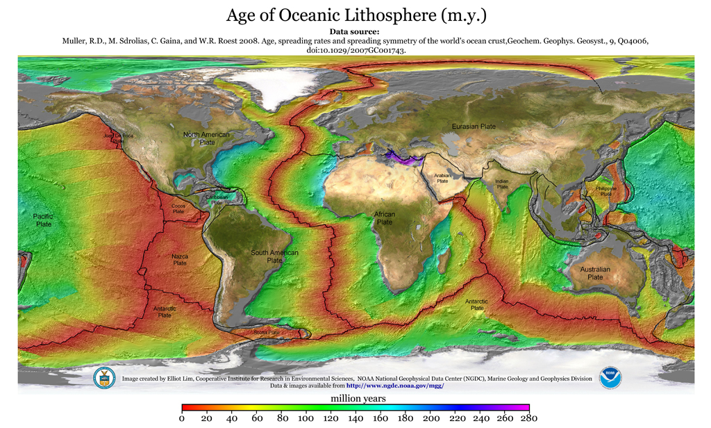
Geologyrocks, according to the sea floor map, how is it exactly that India moved independently from the east coast of Africa all the way up to south Asia, across an oceanic trench, to crash into asia to form the mountains which cannot be explained ANY other way (according to plate tectonics)?
Im confused how a continent can move across a trench which is responsible for the pushing.
When did India “crash” into Eurasia, while the southern continents were a further 2000 miles to the south? That’s where the southern continents were 50 million years ago. Or while 4 continents were at the South Pole did India independently voyage north for 2500 miles? All by itself?
And speaking of physics … physics say every action has an equal and opposite re-action, well we have established it’s the oceanic plate that moves. The continental India is the body of the thing. Think of it like a Volkswagen Beatle crashing into a truck. No matter how that truck crumples … it’s nothing compared to how crushed the Volkswagen would be.
The same thing is true of India. India would be one vast mountain range … it’s not.
the Eurasian mountains are far too gigantic and extensive to be crumpled by puny India.
Look closer. Examine the north of India. This is an impacting body. Yet, the top of it is extensive flatland. So flat, in fact, that it looks almost stretched out. How can this be an impacting body?
Last edited: