90 East Ridge alternative explanation

matthew809

Registered Senior Member
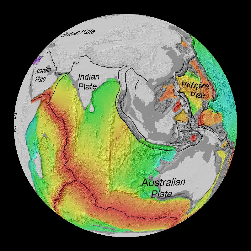
According to Wikipedia, it is commonly theorized that this ridge was caused by a mantle hotspot along with tectonic movement.

But by simply looking at a google map image, the more intuitive and simple explanation is analogous to why a curtain bunches up when opened, or why the cooling pudding skin behaves in a similar manner. It just looks like bunching to me, evident of a time when the ocean crust in that area was still malleable.
Notice that the 90 east ridge is not alone; there are parallel lines to the east. This suggests to me that the force which caused these lines was not due to a mantle hotspot from underneath, but was caused by a sliding and bunching of the land from the east.

Could this possibly even be evidence of earth expansion and a rapid western pacific opening?

449px-NinetyEastRidge.jpg
 
The age of the material in the ridge progresses from north to south, with the northern part being older. This points to being created as the Indian plate moved across a hot spot. There is current study on the area as the wiki states, but it looks to me that major disagreement is the issue of hot spots and how deep they really are.
 
The age of the material in the ridge progresses from north to south, with the northern part being older. This points to being created as the Indian plate moved across a hot spot. There is current study on the area as the wiki states, but it looks to me that major disagreement is the issue of hot spots and how deep they really are.

How are the parallel lines to the east of the ridge accounted for?
 
Would you consider this image an accurate representation of the relative ages of the Indian ocean floor? It doesn't seem to show a clear north to south age gradient. In fact, the area in question, including the parallel ridge lines to the east, all seem to be primarily in the yellow portion, suggesting a common age for the entire ridge line. Am I misinterpreting this map?

sea_floor_age_gray.jpg
 
Personally I don't know much about the ages of parts of the sea floor, so I'm happy enough to let people who have spent their whole lives studying it deal with that sort of thing.

One thing I can tell you is that map doesn't have the resolution to show the sort of things you're looking for. The smallest colour details on it are too large to base a decision on. The pixels are hundreds of km across. It's hard to notice because they've used a linear interpolation to take the square corners off, but if you look at the steppiness of the green shading into yellow east of Sri Lanka you'll see how big the smallest details of the colours on that map are.
 
I don't know the answer to your question, but I don't think we'd expect a gradient of the entire floor of the Indian ocean, as it's all part of the same plate, and not being deposited as places like the Atlantic ridge is, which definitely shows variation. And Michael's point might be valid, that this map is too large to show the differentiation at a smaller scale for just the Indian plate's history.
 
Back
Top